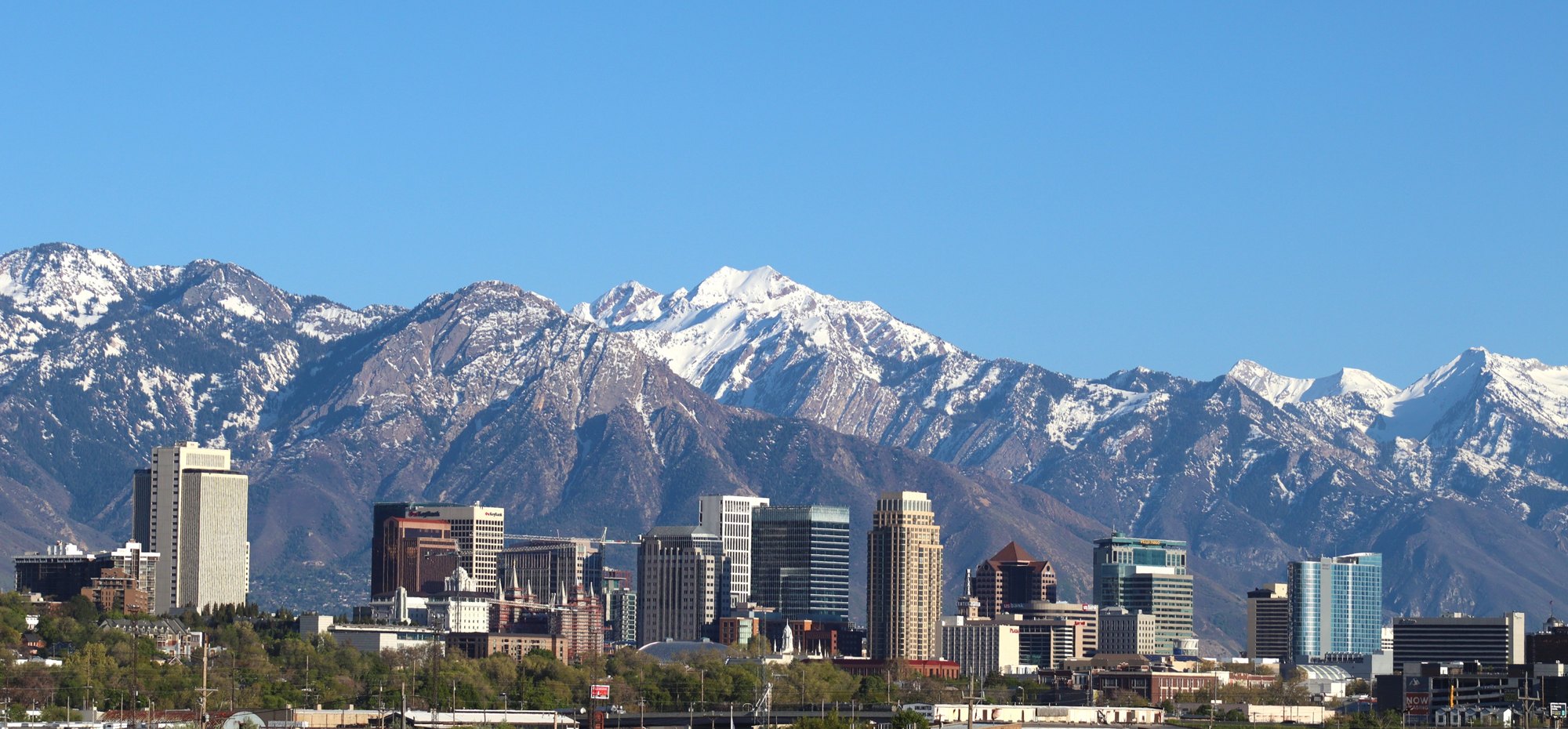
Salt Lake City and the Wasatch foothills

Outdoors

Horseback riding near Salt Lake City

Trails and recreation areas near Salt Lake City open to horseback riding, including horse camps.

12places to ride horses
19 mito the closest
8within 30 miles
February–June, September–Novemberbest months

Good to know: Check trailer parking and stock water at the trailhead, and whether certified weed-free hay is required.

Closest picks

1

North Oquirrh Management Area (NOMA)

19 mi southwest · Bureau of Land Management

The North Oquirrh Management Area is the closest block of public land to the Salt Lake City and associated metropolitan area. The area is important winter habitat for mule deer and elk as well as watershed for the Tooele valley.
2

Granite Flat (Utah)

23 mi southeast · USDA Forest Service

Granite Flat Campground is located a short distance up scenic American Fork Canyon, less than a mile from Tibble Fork Reservoir. Visitors enjoy fishing, canoeing and exploring local trails.

3

Jordanelle Reservoir

25 mi east · Bureau of Reclamation

Jordanelle Dam and Reservoir, features of the Central Utah Project, Bonneville Unit , located on the Provo River about 10 miles north of Heber City, Utah at the 6,130-foot elevation. The reservoir has about 3,050 surface acres when full.

Map of all 12 places

Map of 12 places loads as you scroll.

Within 30 miles (8)

19 mi southwest · Bureau of Land Management

North Oquirrh Management Area (NOMA)

The North Oquirrh Management Area is the closest block of public land to the Salt Lake City and associated metropolitan area. The area is important winter habitat for mule deer and elk as well as watershed for the Tooele valley.

  • Biking
  • Camping
  • Hiking
  • Horseback riding
  • Hunting
  • Photography
  • Wildlife viewing
  • Winter sports

23 mi southeast · USDA Forest Service · Campground

Granite Flat (Utah)

Granite Flat Campground is located a short distance up scenic American Fork Canyon, less than a mile from Tibble Fork Reservoir. Visitors enjoy fishing, canoeing and exploring local trails.

  • Biking
  • Camping
  • Canoeing
  • Fishing
  • Hiking
  • Horseback riding
  • Kayaking
  • Picnicking

25 mi east · Bureau of Reclamation

Jordanelle Reservoir

Jordanelle Dam and Reservoir, features of the Central Utah Project, Bonneville Unit , located on the Provo River about 10 miles north of Heber City, Utah at the 6,130-foot elevation. The reservoir has about 3,050 surface acres when full.

  • Biking
  • Boating
  • Camping
  • Fishing
  • Hiking
  • Horseback riding
  • Hotel/Lodge/Resort Fs Owned
  • Nature education

26 mi east

Rockport State Park

Utah State Park: Idyllic Rockport Reservoir is about three miles long and one-half mile wide. At an elevation of over 6,000 feet, it covers more than 500 acres.

  • Boating
  • Camping
  • Fishing
  • Hiking
  • Horseback riding
  • Paddling
  • Picnicking
  • Swimming

26 mi southeast · USDA Forest Service · Campground

Timpooneke

Timpooneke Campground is located along the beautiful Alpine Loop Scenic Byway high in the Wasatch Mountains. The Mount Timpanogos Wilderness Area is adjacent. Visitors enjoy hiking the Timpooneke Trail to the summit of Mount Timpanogos.

  • Biking
  • Camping
  • Hiking
  • Horseback riding
  • Scenic Drive
  • Wildlife viewing

26 mi southeast

Wasatch Mountain State Park

Launch your family adventure in Wasatch Mountain State Park, minutes from Park City and just an hour’s drive from the SLC International Airport.

  • Biking
  • Camping
  • Hiking
  • Horseback riding
  • Hunting
  • Off-highway vehicles
  • Picnicking
  • Recreational Vehicles

27 mi northwest

Antelope Island State Park

The road to Antelope Island State Park, 25 miles north of Salt Lake City, is a 20-minute straight shot west, but it feels like time travel as you leave the bustle of modern civilization behind.

  • Biking
  • Boating
  • Camping
  • Hiking
  • History
  • Horse Camping
  • Horseback riding
  • Nature education

27 mi east

Historic Union Pacific Rail Trail

Weaving its way from Park City to Echo Reservoir, this 28-mile, non-motorized trail provides a close up view of area wildlife and wildflowers. Explore the trail on foot, mountain bike, skis, or horseback.

  • Biking
  • Hiking
  • Horseback riding
  • Wildlife viewing
  • Winter sports

30 to 75 miles (4)

32 mi southeast

Deer Creek State Park

Utah State Parks: Windsurf, boat, zip line and fish on the cool waters of Deer Creek Reservoir. The nearly 3,000-acre reservoir has predictable winds for excellent water sports and five species of sport fish.

  • Boating
  • Camping
  • Fishing
  • Hiking
  • Horseback riding
  • Hunting
  • Off-highway vehicles
  • Picnicking

39 mi west · Bureau of Land Management

North Stansbury Mountains

The North Stansbury WSA, which encompasses 10,480 acres, is 40 miles west of Salt Lake City. The WSA is north of the Deseret Peak Wilderness managed by the Wasatch-Cache National Forest.

  • Camping
  • Hiking
  • Horseback riding
  • Hunting
  • Nature education
  • Photography
  • Wildlife viewing
  • Winter sports

39 mi east · USDA Forest Service

Uinta-Wasatch-Cache National Forest

  • Biking
  • Boating
  • Camping
  • Fishing
  • Hiking
  • Horse Camping
  • Horseback riding
  • Off-highway vehicles

40 mi southwest · Bureau of Land Management

Pony Express Back Country Byway (BCB)

The Pony Express National Historic Trail was a cross-country route used by young men on horses or mules to carry the nation's priority mail from Missouri to California from 1860 to 1861.

  • Accessible Facility Or Activity
  • Biking
  • Camping
  • Hiking
  • Horseback riding
  • Hunting
  • Nature education
  • Photography

Distances are straight-line miles from downtown Salt Lake City. Listings come from Recreation.gov’s federal recreation database; check each official page for hours, fees, fire restrictions and closures before you go.

Get outside around Salt Lake City

Top 5 things to do in Salt Lake City, Utah! Check out my YouTube video for more! video thumbnail

THINGS TO DO · YOUTUBE SHORT

Top 5 things to do in Salt Lake City, Utah! Check out my YouTube video for more!

A local activity Short shared by Mahna Ghafori.

Watch on YouTube ↗

Around Salt Lake City

Bus stands at Ballpark station, Salt Lake City, Utah
Bus stands at Ballpark station, Salt Lake City, Utah, Oct 16An Errant Knight · CC BY-SA 4.0
LDS genealogy library slc utah, Salt Lake City
LDS genealogy library slc utahRicardo630 · Public domain
Capitol Theater Salt Lake City
Capitol Theater Salt Lake City 005claralieu · CC BY 2.0

More outdoors near Salt Lake City

Questions

Where is the closest place for horseback riding near Salt Lake City?

North Oquirrh Management Area (NOMA) (Bureau of Land Management), about 19 miles southwest of Salt Lake City as the crow flies. Next are Granite Flat (Utah) (23 mi) and Jordanelle Reservoir (25 mi).

When is the best time for horseback riding near Salt Lake City?

Based on Salt Lake City’s average highs, February–June, September–November. Conditions at higher elevations can be much cooler.

Who manages these places?

Federal agencies including Bureau of Land Management, USDA Forest Service, Bureau of Reclamation. Each listing links to its official page for hours, fees, closures and current conditions.

Salt Lake City AI

Your Salt Lake City local guide
Hey there!

I'm Salt Lake City AI. Ask about neighborhood food, independent shops, local history or planning a visit.

AI recommendations may be inaccurate. Verify hours and prices. Questions are processed by Cloudflare. Privacy