Salt Lake City weatherWhat’s on in Salt Lake City →Events →
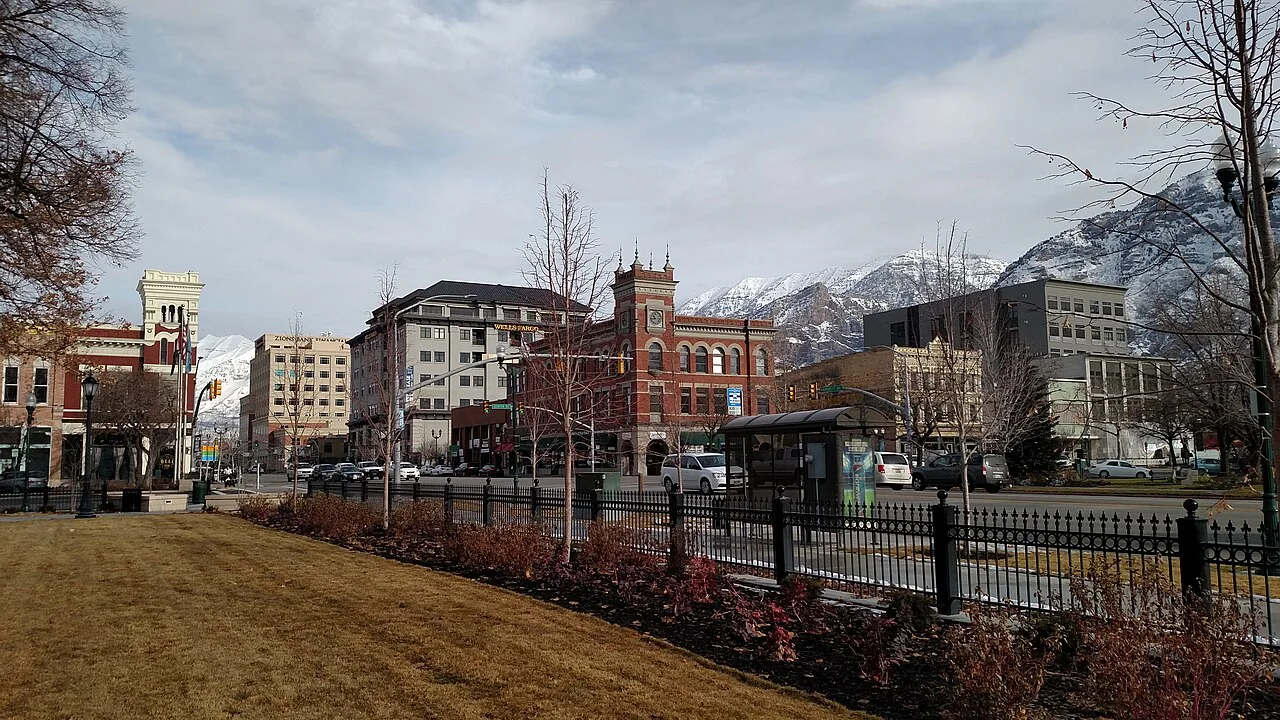
Provo

Get out of town

Day trips from Salt Lake City

16 nearby parks, towns and places to explore, ordered by straight-line distance.

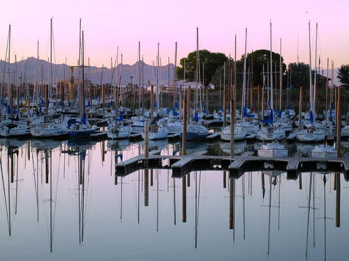
Great Salt Lake State ParkState park

Great Salt Lake State Park

17 miles west · straight-line distance

State park in Magna, Utah, United States.

BikingBoatingCampingPaddlingRecreational VehiclesWildlife viewingAgency site ↗

Confirm the visitor entrance, hours, reservations, access and seasonal conditions. Islands or water destinations may require different transport.
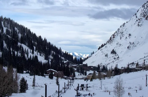
Alta Ski AreaSki area

Alta Ski Area

18 miles southeast · straight-line distanceSaved road-route estimate: 28 miles · 45 min

Ski resort in Alta, Utah, United States.

Confirm the visitor entrance, hours, reservations, access and seasonal conditions. Islands or water destinations may require different transport.
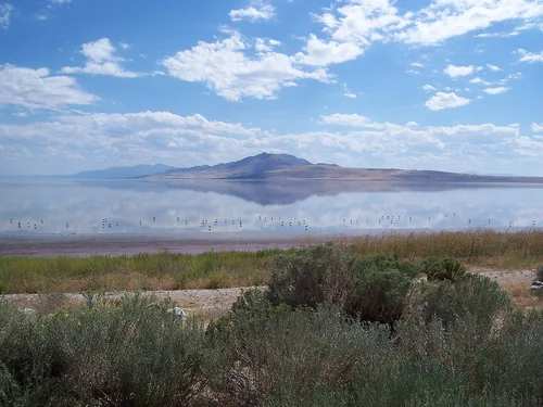
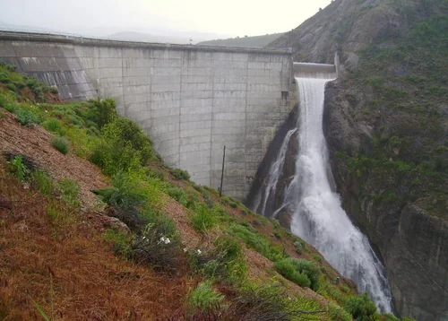
East Canyon State ParkState park

East Canyon State Park

19 miles northeast · straight-line distance

State park in Morgan County, Utah, United States.

BoatingCampingFishingHikingHistoryHunting

Confirm the visitor entrance, hours, reservations, access and seasonal conditions. Islands or water destinations may require different transport.
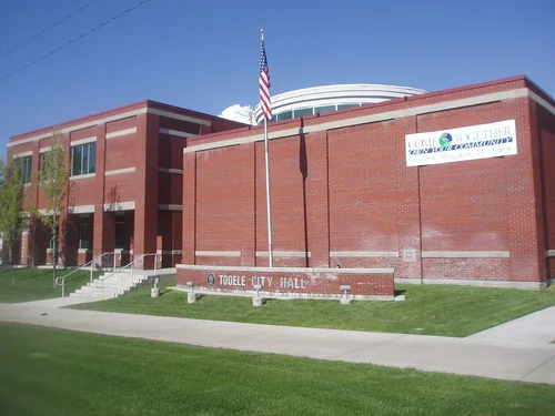
Antelope Island State ParkState park

Antelope Island State Park

21 miles northwest · straight-line distance

State park in Davis County, Utah, United States.

Confirm the visitor entrance, hours, reservations, access and seasonal conditions. Islands or water destinations may require different transport.
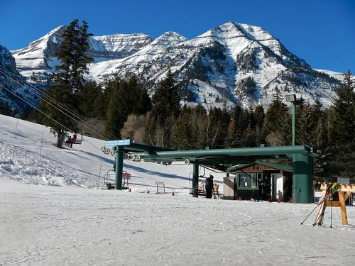
Town

Park City

22 miles east · straight-line distanceAbout 35 min by car (32 road miles, typical traffic, checked October 2026)

City in Summit County, Utah, United States.

Confirm the visitor entrance, hours, reservations, access and seasonal conditions. Islands or water destinations may require different transport.
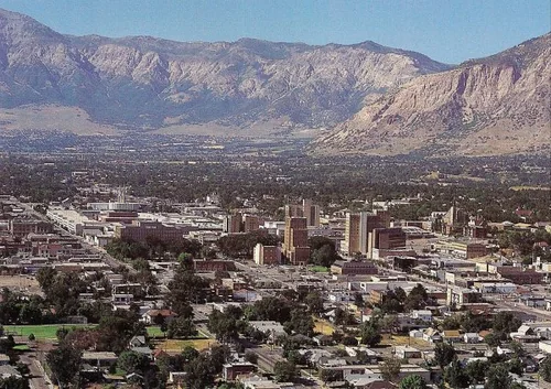
National park site

Timpanogos Cave National Monument

24 miles southeast · straight-line distance

National monument in Utah County, Utah, United States.

HikingAgency site ↗

Confirm the visitor entrance, hours, reservations, access and seasonal conditions. Islands or water destinations may require different transport.
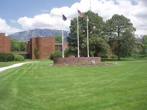
TooeleTown

Tooele

27 miles southwest · straight-line distanceAbout 35 min by car (34 road miles, typical traffic, checked October 2026)

City in and county seat of Tooele County, Utah, United States.

Confirm the visitor entrance, hours, reservations, access and seasonal conditions. Islands or water destinations may require different transport.
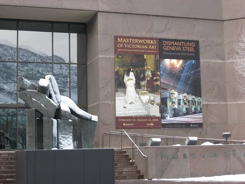
Sundance ResortSki area

Sundance Resort

30 miles southeast · straight-line distanceAbout 55 min by car (50 road miles, typical traffic, checked October 2026)

Resort in the Wasatch Range in Utah County, Utah, United States.

Confirm the visitor entrance, hours, reservations, access and seasonal conditions. Islands or water destinations may require different transport.
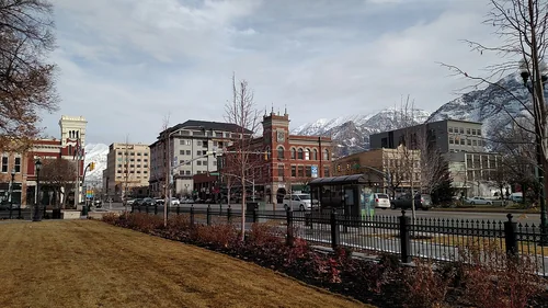
OgdenTown

Ogden

32 miles north · straight-line distanceAbout 40 min by car (40 road miles, typical traffic, checked October 2026)

City in and county seat of Weber County, Utah, United States.

Confirm the visitor entrance, hours, reservations, access and seasonal conditions. Islands or water destinations may require different transport.
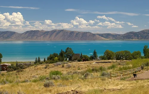
OremTown

Orem

34 miles south · straight-line distanceAbout 40 min by car (39 road miles, typical traffic, checked October 2026)

City in Utah County, Utah, United States.

Confirm the visitor entrance, hours, reservations, access and seasonal conditions. Islands or water destinations may require different transport.
Brigham Young University Museum of ArtThings to do

Brigham Young University Museum of Art

37 miles south · straight-line distanceAbout 50 min by car (45 road miles, typical traffic, checked October 2026)

Art museum in Provo, Utah, United States.

Confirm the visitor entrance, hours, reservations, access and seasonal conditions. Islands or water destinations may require different transport.

ProvoTown

Provo

38 miles south · straight-line distanceAbout 45 min by car (48 road miles, typical traffic, checked October 2026)

City in and county seat of Utah County, Utah, United States.

Confirm the visitor entrance, hours, reservations, access and seasonal conditions. Islands or water destinations may require different transport.

National park site

Golden Spike National Historical Park

69 miles northwest · straight-line distance

National historical park in Box Elder County, Utah, United States.

Confirm the visitor entrance, hours, reservations, access and seasonal conditions. Islands or water destinations may require different transport.

Things to do

Fort Bridger

87 miles northeast · straight-line distanceAbout 1 hr 40 min by car (116 road miles, typical traffic, checked October 2026)

Former fort, open-air museum, and state park in Fort Bridger, Wyoming, United States.

Confirm the visitor entrance, hours, reservations, access and seasonal conditions. Islands or water destinations may require different transport.

Bear LakeLake

Bear Lake

90 miles north · straight-line distance

Natural freshwater lake on the Utah-Idaho border in the United States.

Confirm the visitor entrance, hours, reservations, access and seasonal conditions. Islands or water destinations may require different transport.

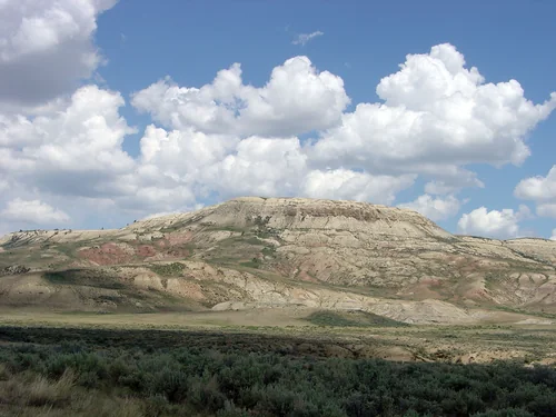
Fossil Butte National MonumentNational park site

Fossil Butte National Monument

96 miles northeast · straight-line distance

National monument in the United States.

Confirm the visitor entrance, hours, reservations, access and seasonal conditions. Islands or water destinations may require different transport.

Driving times are typical estimates from the city center without live traffic, Powered by Geoapify · © OpenStreetMap contributors.

Distances are straight-line measurements from the city, not driving distance. Saved road estimates have no consistently recorded source date and are not current traffic; estimates to park centers, water locations or inconsistent routes are omitted. Named-destination route links are not verified entrances. Place descriptions come from Wikidata; photo credits below include recorded capture dates when available. A photograph does not show current conditions.

Outdoor places near Salt Lake City

40 recreation areas and campgrounds within 44 miles, from Recreation.gov. Filter by what you want to do.

Recreation area

This Is the Place Heritage Park

4 miles east · straight-line distance

Journey back in time at This Is The Place Heritage Park, a collection of more than 50 historic homes and buildings brought to life by historical interpreters.

BikingDocumentary SiteHikingHistoryInformation SitePicnickingRanger programs

Recreation area

Jordan River OHV State Recreation Area

5 miles northwest · straight-line distance

This OHV destination is perfect for digging into the dirt. Four tracks, including two motocross (MX) tracks for off-highway motorcyclists, and two dual-purpose OHM and ATV tracks fill the space.

Off-highway vehicles

Campground

Mueller Park Group Picnic

8 miles northeast · straight-line distanceAbout 20 min by car (13 road miles, checked October 2026)USDA Forest Service

Mueller Park Group Picnic Area is located just 5 miles from Bountiful, Utah, at an elevation of 5,400 feet. Visitors enjoy relaxing in the shade along Mill Creek and exploring local trails.

BikingCampingHikingPicnicking

Campground

Dogwood Day Use

11 miles southeast · straight-line distanceAbout 20 min by car (18 road miles, checked October 2026)USDA Forest Service

Dogwood Day Use Picnic Area is just 2 miles up Big Cottonwood Canyon, conveniently close to Salt Lake City. Big Cottonwood Creek runs alongside the site. Visitors enjoy fishing, hiking and biking.

BikingCampingClimbingFishingHikingPicnickingScenic Drive

Campground

Storm Mountain Day Use Area

12 miles southeast · straight-line distanceAbout 25 min by car (20 road miles, checked October 2026)USDA Forest Service

Storm Mountain Day Use Area is just 3 miles up Big Cottonwood Canyon, conveniently close to Salt Lake City. Big Cottonwood Creek runs alongside the site. Visitors enjoy fishing, hiking and biking.

BikingCampingFishingHikingRock ClimbingScenic Drive

Campground

Jordan Pines

15 miles southeast · straight-line distanceAbout 35 min by car (26 road miles, checked October 2026)USDA Forest Service

Jordan Pines Campground is located in scenic Big Cottonwood Canyon at an elevation of 7500 feet. Salt Lake City is conveniently close. Visitors enjoy hiking, biking and fishing.

BikingCampingFishingHikingRock ClimbingWildlife viewing

Campground

Bountiful Peak Campground

16 miles north · straight-line distanceAbout 1 hr by car (27 road miles, checked October 2026)USDA Forest Service

Bountiful Peak Campground is set in an alpine basin high in the Wasatch Mountains at an elevation of 7,500 feet. Farmington, Utah, is 9 miles away. Visitors enjoy exploring local trails on foot, bike and off-road vehicles.

BikingCampingFishingHikingMountain BikingPicnickingScenic DriveWildlife viewing

Campground

Spruces - Big Cottonwood

16 miles southeast · straight-line distanceAbout 40 min by car (27 road miles, checked October 2026)USDA Forest Service

Spruces Campground is located in scenic Big Cottonwood Canyon at an elevation of 7,500 feet. Salt Lake City is conveniently close. Visitors enjoy hiking, biking and fishing.

BackpackingBikingCampingFishingHikingMountain BikingRock ClimbingScenic Drive

Campground

Tanners Flat

16 miles southeast · straight-line distanceAbout 30 min by car (25 road miles, checked October 2026)USDA Forest Service

Tanners Flat Campground is located in scenic Little Cottonwood Canyon at an elevation of 7,200 feet, just 6 miles from Sandy, Utah. The canyon offers many hiking and biking opportunities.

BikingCampingFishingHikingScenic Drive

Recreation area

Great Salt Lake State Park

17 miles west · straight-line distance

Utah State Parks: Great Salt Lake State Park provides boat slips, public viewpoints of Great Salt Lake, sail and motorboat access, and a search and rescue operations center.

BikingBoatingCampingPaddlingRecreational VehiclesWildlife viewing

Campground

Albion Basin

19 miles southeast · straight-line distanceAbout 55 min by car (32 road miles, checked October 2026)USDA Forest Service

Albion Basin Campground, just 15 miles from Sandy, Utah, is set among shady white pines and aspens in its beautiful namesake basin in Little Cottonwood Canyon at an elevation of 9,500 feet.

BikingCampingFishingHikingWildlife viewing

Recreation area

East Canyon State Park

19 miles northeast · straight-line distance

Tucked away in the mountains of northeastern Utah on the Wasatch Back, East Canyon Reservoir is a popular destination for boating, fishing, and camping that is only 45 minutes from Salt Lake.

BoatingCampingFishingHikingHistoryHuntingOff-highway vehiclesPicnicking

Recreation area

North Oquirrh Management Area (NOMA)

19 miles southwest · straight-line distanceBureau of Land Management

The North Oquirrh Management Area is the closest block of public land to the Salt Lake City and associated metropolitan area. The area is important winter habitat for mule deer and elk as well as watershed for the Tooele valley.

BikingCampingHikingHorseback ridingHuntingPhotographyWildlife viewingWinter sports

Campground

Redman Campground

19 miles southeast · straight-line distanceAbout 40 min by car (30 road miles, checked October 2026)USDA Forest Service

Redman Campground is located in scenic Big Cottonwood Canyon at an elevation of 8,300 feet. Salt Lake City is conveniently close. Visitors enjoy hiking, biking and fishing.

BikingCampingFishingHikingMountain BikingRock ClimbingWildlife viewing

Recreation area

East Canyon Reservoir

20 miles northeast · straight-line distanceBureau of Reclamation

Recreation at East Canyon Dam and reservoir, a feature of the Weber Basin Project, is managed by the Utah Division of Parks and Recreation under agreement with the Bureau of Reclamation.

BoatingCampingFishingHotel/Lodge/Resort Fs OwnedPicnickingRecreational VehiclesWater sportsWinter sports

Recreation area

Flight Park State Recreation Area

21 miles south · straight-line distance

Utah State Parks and Recreation and the Utah Hang Gliding and Paragliding Association (UHGPGA) are partnering to preserve this unique recreation area that is an excellent site for teaching and gathering experience for flyers of all levels.

Information SiteObservation Site

Campground

Granite Flat (Utah)

23 miles southeast · straight-line distanceAbout 50 min by car (40 road miles, checked October 2026)USDA Forest Service

Granite Flat Campground is located a short distance up scenic American Fork Canyon, less than a mile from Tibble Fork Reservoir. Visitors enjoy fishing, canoeing and exploring local trails.

BikingCampingCanoeingFishingHikingHorseback ridingKayakingPicnicking

Campground

Little Mill

24 miles southeast · straight-line distanceAbout 40 min by car (37 road miles, checked October 2026)USDA Forest Service

Little Mill Campground is located in American Fork Canyon on the banks of American Fork Creek. This popular campground is a great place to escape the hot summer days while hiking or fishing.

CampingFishingHikingPicnickingScenic DriveWildlife viewing

Recreation area

Timpanogos Cave National Monument

24 miles southeast · straight-line distanceNational Park Service

Visitors must be on a cave tour in order to enter the cave. Hike your way past stunning vistas to explore a hidden underground world. Taste the thrill of caving as you twist and bend to enter beautifully decorated rooms.

Hiking

Recreation area

Jordanelle Reservoir

25 miles east · straight-line distanceBureau of Reclamation

Jordanelle Dam and Reservoir, features of the Central Utah Project, Bonneville Unit , located on the Provo River about 10 miles north of Heber City, Utah at the 6,130-foot elevation. The reservoir has about 3,050 surface acres when full.

BikingBoatingCampingFishingHikingHorseback ridingHotel/Lodge/Resort Fs OwnedNature education

Recreation area

Rockport Reservoir

25 miles east · straight-line distanceBureau of Reclamation

Rockport Reservoir, Weber Basin Project , was formed by the construction of Wanship Dam on the Weber River.

BikingBoatingCampingFishingHikingPicnickingRecreational VehiclesWater sports

Campground

Altamont

26 miles southeast · straight-line distanceAbout 50 min by car (41 road miles, checked October 2026)USDA Forest Service

Altamont Campground is located along the beautiful Alpine Loop Scenic Byway high in the Wasatch Mountains. The Mount Timpanogos Wilderness Area is adjacent.

BikingCampingHikingPicnickingScenic DriveWildlife viewing

Recreation area

Jordanelle State Park

26 miles east · straight-line distance

Nestled in the rolling mountains north of Heber City, Utah sits the beautiful Jordanelle Reservoir, fed by the Provo River and impounded by the Jordanelle Dam.

BikingBoatingCampingDivingFishingHikingPaddlingPhotography

Recreation area

Rockport State Park

26 miles east · straight-line distance

Utah State Park: Idyllic Rockport Reservoir is about three miles long and one-half mile wide. At an elevation of over 6,000 feet, it covers more than 500 acres.

BoatingCampingFishingHikingHorseback ridingPaddlingPicnickingSwimming

Campground

Timpooneke

26 miles southeast · straight-line distanceAbout 50 min by car (41 road miles, checked October 2026)USDA Forest Service

Timpooneke Campground is located along the beautiful Alpine Loop Scenic Byway high in the Wasatch Mountains. The Mount Timpanogos Wilderness Area is adjacent. Visitors enjoy hiking the Timpooneke Trail to the summit of Mount Timpanogos.

BikingCampingHikingHorseback ridingScenic DriveWildlife viewing

Recreation area

Wasatch Mountain State Park

26 miles southeast · straight-line distance

Launch your family adventure in Wasatch Mountain State Park, minutes from Park City and just an hour’s drive from the SLC International Airport.

BikingCampingHikingHorseback ridingHuntingOff-highway vehiclesPicnickingRecreational Vehicles

Recreation area

Antelope Island State Park

27 miles northwest · straight-line distance

The road to Antelope Island State Park, 25 miles north of Salt Lake City, is a 20-minute straight shot west, but it feels like time travel as you leave the bustle of modern civilization behind.

BikingBoatingCampingHikingHistoryHorse CampingHorseback ridingNature education

Recreation area

Historic Union Pacific Rail Trail

27 miles east · straight-line distance

Weaving its way from Park City to Echo Reservoir, this 28-mile, non-motorized trail provides a close up view of area wildlife and wildflowers. Explore the trail on foot, mountain bike, skis, or horseback.

BikingHikingHorseback ridingWildlife viewingWinter sports

Recreation area

Echo Reservoir

28 miles northeast · straight-line distanceBureau of Reclamation

Recreation at Echo Dam and reservoir, Weber River Project , is managed by Echo Resort under agreement with the Bureau of Reclamation.

BikingBoatingCampingFishingHikingPicnickingRecreational VehiclesWater sports

Campground

Mt. Timpanogos

29 miles southeast · straight-line distanceAbout 1 hr by car (53 road miles, checked October 2026)USDA Forest Service

Mt. Timpanogos Campground is located along the beautiful Alpine Loop Scenic Byway in the Wasatch Mountains. The Mount Timpanogos Wilderness Area is adjacent. Visitors enjoy hiking the Aspen Grove Trail to the summit of Mount Timpanogos.

BikingCampingHikingScenic DriveWildlife viewing

Campground

Theater In The Pines

29 miles southeast · straight-line distanceAbout 55 min by car (53 road miles, checked October 2026)USDA Forest Service

Theater in the Pines is a large group campsite located along the beautiful Alpine Loop Scenic Byway in the Wasatch Mountains. The Mount Timpanogos Wilderness Area is adjacent.

BikingCampingHikingPicnickingScenic DriveWildlife viewing

Recreation area

Deer Creek Reservoir

32 miles southeast · straight-line distanceBureau of Reclamation

Recreation at Deer Creek Dam and Reservoir, Provo River Project, is managed by the Utah Division of Parks and Recreation under agreement with the Bureau of Reclamation.

BikingBoatingCampingFishingHikingPicnickingRecreational VehiclesWater sports

Recreation area

Deer Creek State Park

32 miles southeast · straight-line distance

Utah State Parks: Windsurf, boat, zip line and fish on the cool waters of Deer Creek Reservoir. The nearly 3,000-acre reservoir has predictable winds for excellent water sports and five species of sport fish.

BoatingCampingFishingHikingHorseback ridingHuntingOff-highway vehiclesPicnicking

Campground

Anderson Cove (Uinta-Wasatch-Cache National Forest, UT)

34 miles north · straight-line distanceAbout 50 min by car (45 road miles, checked October 2026)USDA Forest Service

Anderson Cove Campground is a popular facility located 10 miles east of Ogden, Utah, on the banks of Pineview Reservoir in scenic Ogden Valley. Visitors enjoy boating, fishing and swimming.

BoatingCampingFishingPicnickingSwimmingWater sports

Recreation area

Camp Floyd State Park Museum

37 miles south · straight-line distance

Utah State Park: The Camp Floyd Commissary and Museum were constructed in 1858 by the soldiers of Johnston’s Army. The Commissary Building served as a store of military equipment and provisions.

Documentary SiteHistoryInformation SiteObservation Site

Recreation area

Utah Lake State Park

37 miles south · straight-line distance

Utah State Parks: Utah’s largest freshwater lake provides fishing access for channel catfish, walleye, white bass, black bass, and several species of panfish.

BoatingCampingFishingPaddlingPhotographyPicnickingWater sportsWinter sports

Recreation area

North Stansbury Mountains

39 miles west · straight-line distanceBureau of Land Management

The North Stansbury WSA, which encompasses 10,480 acres, is 40 miles west of Salt Lake City. The WSA is north of the Deseret Peak Wilderness managed by the Wasatch-Cache National Forest.

CampingHikingHorseback ridingHuntingNature educationPhotographyWildlife viewingWinter sports

Recreation area

Uinta-Wasatch-Cache National Forest

39 miles east · straight-line distanceUSDA Forest Service

BikingBoatingCampingFishingHikingHorse CampingHorseback ridingOff-highway vehicles

Recreation area

Pony Express Back Country Byway (BCB)

40 miles southwest · straight-line distanceBureau of Land Management

The Pony Express National Historic Trail was a cross-country route used by young men on horses or mules to carry the nation's priority mail from Missouri to California from 1860 to 1861.

Accessible Facility Or ActivityBikingCampingHikingHorseback ridingHuntingNature educationPhotography

Recreation area

Horseshoe Springs Wildlife Management Area (WMA)

44 miles west · straight-line distanceBureau of Land Management

Horseshoe Springs is both a Wildlife Management Area (WMA) and a historic site on the California National Historic Trail located in Skull Valley, Tooele County, Utah.

FishingHikingNature educationPhotographyWildlife viewing

Recreation areas and campgrounds from Recreation.gov's directory, checked October 9, 2026. Listings are not live availability: check Recreation.gov or the managing agency for open dates, fees, reservations and conditions. Directions go to the listed coordinates, which may not be the entrance. Campground driving times: Powered by Geoapify · © OpenStreetMap contributors.

Questions

What day-trip ideas are near Salt Lake City?

This guide includes Great Salt Lake State Park, Alta Ski Area, East Canyon State Park, Antelope Island State Park, Park City. Places are ordered by straight-line distance. Confirm visitor access, opening hours and current travel conditions before choosing a trip.

How far is Great Salt Lake State Park from Salt Lake City?

Approximately 17 miles west in a straight line. This is not current traffic or a route to a verified visitor entrance. Use the named destination and confirm the appropriate entrance or transport.

How far is Alta Ski Area from Salt Lake City?

Approximately 18 miles southeast in a straight line; a saved road-route estimate is 28 miles and 45 min. This is not current traffic or a route to a verified visitor entrance. Use the named destination and confirm the appropriate entrance or transport.

How far is East Canyon State Park from Salt Lake City?

Approximately 19 miles northeast in a straight line. This is not current traffic or a route to a verified visitor entrance. Use the named destination and confirm the appropriate entrance or transport.

Where can I camp near Salt Lake City?

Recreation.gov lists 16 campgrounds within 34 miles, including Mueller Park Group Picnic (8 miles northeast), Dogwood Day Use (11 miles southeast), Storm Mountain Day Use Area (12 miles southeast). Check Recreation.gov for current availability, seasons and reservations.

Local events, things to do, and independent businesses worth knowing.

Salt Lake City AI

Your Salt Lake City local guide
Hey there!

I'm Salt Lake City AI. Ask about neighborhood food, independent shops, local history or planning a visit.

AI recommendations may be inaccurate. Verify hours and prices. Questions are processed by Cloudflare. Privacy